-A note by Ethiopian- and Sudanese-American professionals to the African Union.
Egypt, Ethiopia, and Sudan have been in intense negotiation for the last several weeks. The three countries have restarted their latest round of negotiations under the leadership of the African Union, who called an emergency meeting on June 26, 2020, after the three countries had failed to advance in their earlier negotiations that lasted for two weeks. Subsequent engagements appear to show progress in the right direction. On July 24, 2020, the African Union released a communiqué on the current progress and what is coming ahead.
Even though all participants stated that progress was made, there appears to be significant disagreement between the parties. Since then, the trilateral negotiation has started and stopped several times.
Major disagreements on key issues remain, including the need to have a flexible agreement that recognizes changes in the Blue Nile water flow because of future developments upstream and/or climate change, how to deal with prolonged drought and share resources under such circumstances, and how to resolve future disputes without going through a protracted process. In addition, Ethiopia contends the Grand Ethiopian Renaissance Dam (GERD) release proposal by Egypt is based on status quo water sharing outlined by the 1959 agreement between the Sudan and Egypt for which it is not a party.
In other words, there is a lot to do.
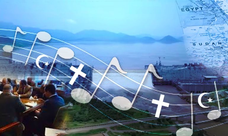
While political-level disagreements exist between the three countries, history tells a different story. The three countries are intertwined through a common history. They are closely tied in religion; the majority of the people of Sudan and Egypt and one-third of Ethiopians practice Islam. Egypt and Orthodox Ethiopian Christians have a very long relationship whereby the Egyptian Coptic Church used to appoint the Ethiopian archbishop known as abuna (Arabic: “our father”) until 1950.
Ethiopia and the Sudan are culturally linked and share a close geographical boundary. Prominent Sudanese artists like the late Mohammed Wardi are household names in Ethiopia and the late great Ethiopian singer Tilahune Gessesse, is one of the most popular Ethiopian singers in Sudan having made several trips to participate in musical and cultural festivals. It is not new for these three countries’ people to have a close connection because the region has been culturally and religiously intertwined for centuries as referenced in historical documents and books.
In our professional opinion, the three countries need to keep the big picture in mind and find a way that is a “win-win” for all. This is possible, if there is the political will to move forward a common agenda.
Transboundary water resources sharing examples are common throughout the world. Resource sharing is based on agreements between nations, states/provinces within nations and even sometimes between municipalities. There is a lot to learn from their experiences.
Countries with an international watercourse (representing both surface and groundwater) are best served in a cooperative framework. This avoids two pitfalls: sub-optimal utilization of natural resources where each country is looking after its own interest and often with conflicting objectives; and as a result, primary modes of interaction among countries which causes animosity. This will leave countries spending more time and money on how to “fight” each other rather than figuring out what is the best that they can gain out of the resources they have in an economically sensible way. Penny wise, pound foolish!
In the following paragraphs we would like to share three distinct examples of transboundary water resources projects to garner experiences that may help in understanding and drawing the framework for long-term and inclusive agreements between Ethiopia, Egypt and the Sudan.
Vista House and the Columbia River from the air, name of photographer Raymond Siler
The Columbia River, Canada and United States
The Columbia River Basin is home to several dams in Canada and the United States. Three dams were constructed in Canada to provide flood control and optimal hydropower generation within the Columbia River Basin. The treaty between the United States and Canada, ratified in 1964 after 20 years of negotiations, had provisions for future negotiation. The purpose of the treaty was to improve flood risk management and increase hydropower production. One important aspect of the treaty allows any one country to request termination (any time after 2024), as long as a 10 year advance notice is given. Currently both countries are renegotiating terms that recognize changes that were not envisioned in the original treaty.
In the United States, Columbia River power generation accounts for about 40% of US total hydropower generation. Like the Blue Nile, about 60% of the natural runoff basin occurs in three months (May through July). Total water storage in the Columbia River system is about 68 Billion Cubic Meters (BCM) where 52 BCM are available for coordination, which accounts for about 30% annual runoff. The Canadian portion produces about 30% to 35% of total runoff because of significant snow. In addition to the treaty, there are several short-term agreements between Canada and the United States. One such agreement was made in September 2013, where the Treaty Entities signed a short-term agreement to address some of Canada’s concerns about the timing of water releases from the Libby Dam. Among agreed points were the fact that Canada will be compensated for energy losses at its Kootenay Canal operations that result from the timing of water releases from the Libby Dam.
Dam operations are closely coordinated by both Canada and the United States given the significant seasonal nature of runoff in the river basin. In addition to coordination between the two countries, there are several agencies in the United States that closely coordinate this operation between different stakeholders including several private sectors. This seamless coordination allows for resource optimization by looking at the entire river basin as one system. There are several administrative layers, but technical operations are managed by the Columbia River Treaty (CRT) Operating and Hydro-meteorological Committees who provide annual reports.
Key lessons from this example are great coordination and a flexible framework which allows resource optimization in the basin. Subsequent negotiations after an agreement allowed both countries to adapt to specific situations that may not be anticipated at the time of signing. This allowed optimal utilization of resources by both countries and avoided any potential conflict.
Colorado River, name of photographer Billy Hathorn
The Colorado River, United States and Mexico
The Colorado River Basin covers approximately 594,000 square kilometers in the United States and Mexico. In the United States, that includes 7 states: Colorado, Wyoming, Utah, New Mexico, Arizona, Nevada, and California.
The Colorado River system is characterized by wide variations in annual runoff, with the observed maximum inflow exceeding 20.3 Billion Cubic Meter (BCM) and an observed minimum inflow of about 3.2 BCM. The system has ten major regulating reservoirs with a total combined storage capacity of approximately 46 BCM, almost four times the watershed’s historical runoff value. Operation of the reservoir system attempts to store water from surplus years and carry over these supplies for release during drought years.
In the United States and Mexico, the Colorado River supplies more than 40 million people with a renewable water supply and energy through hydropower. In addition, the river system provides water for more than 5.5 million acres of irrigated agriculture, which provides 15% of total U.S. crop production. The dams along the river system have hydro-electric power plants with a total generating capacity of 4,177.8 MWH.
The Colorado River Compact of 1922 appropriated about 6 BCM water per year to both the Upper Basin and Lower Basin States of the Colorado River. In 1944, The Mexican Water treaty authorized Mexico to take 1.2 BCM of water per year.
Shortage in the Lower Basin is driven by the elevation of water storage in Lake Mead, with the 2007 Interim Guidelines providing guidance on how much Colorado River water would be delivered during a Lower Basin shortage. In 2007, the Record of Decision on the Colorado River Interim Guidelines for Lower Basin Shortages and the Coordinated Operations for Lake Powell and Lake Mead was signed, outlining reductions that Arizona and Nevada (Lower Colorado River basin states) would take under different levels of shortage. These 2007 Guidelines define how Lake Powell and Lake Mead are to operate in coordination to minimize impacts of reduced water supplies to the Colorado River system by identifying specific reductions in deliveries to Lower Basin water users as Lake Mead declines in elevation.
In 2012, Minute 319 was signed and this required that Mexico share reductions with Arizona and Nevada during a Lower Basin shortage. Even with the 2007 Interim Guidelines in place to mitigate the decline of reservoir levels due to diminished flows into the Colorado River System, future projections indicate that large reductions in Lake Powell and Lake Mead storage are likely to occur. Lower flows into Lake Powell are partially responsible for the decrease in Lake Mead levels, but there is also a supply/demand imbalance, facing the Lower Basin States. Given annual state apportionments in the Lower Basin, the 1.2 BCM annual allocation to Mexico, and 6.7 BCM normal annual release from Lake Powell, Lake Mead storage still declines approximately 3.6 meter per year, corresponding to approximately 1.2 million acre-feet deficit at current reservoir elevations.
The average supply/demand imbalance for the Colorado River Basin is projected to be approximately 3.2 million acre-feet by the year 2060. This implies that shortage in the Colorado River Basin (as well as ever growing water demands) has a higher probability of occurrence in the future.
The risks of Lake Mead falling below critically low reservoir elevations has significantly increased over the past decade, increasing the risks of shortage reductions in the basin and threatening the health of the river for all users. There is uncertainty about what would happen if Lake Mead, the Lower Basin’s principal reservoir, dropped to very low levels, falling well into its shortage threshold for the Lower Colorado Basin states. Previous agreements and guidelines designed to protect the system against such impacts of prolonged drought may be insufficient to address the current challenges to the system. These new realities led to the development and adoption of the Colorado River Basin’s Drought Contingency Plan (DCP).
The DCP is a set of agreements designed to protect the Colorado River system through voluntary reductions and increased conservation. The agreements were developed through a collaborative process amongst the federal government, basin states, water users and Mexico. DCP will not prevent a Colorado River shortage but will enable basin states at risk to have more certainty on securing reliable water supplies by sharing reductions amongst the basin states and Mexico. In fact, modeling projections have shown that DCP would reduce the risks of Lake Mead falling below critical elevations.
The DCP Authorization Act was signed into law in 2019 and went into effect in 2020. The DCP agreement lasts through 2026, at which point new negotiated guidelines (to replace the 2007 Interim Guidelines) would begin for the period post-2026.
The biggest take-away from the Colorado River Basin is the importance of partnership and collaboration. Even when disputes between water users and states occurred during the many years after the ratification of the Colorado River Compact in 1922 (e.g. Arizona vs. California Supreme Court case), there was no path forward in the basin until all parties agreed to work together; not just to resolve smaller disagreements amongst themselves, but to begin to address larger issues that threaten the long-term sustainability of the system. This led to innovative ideas and agreements to take place within the basin for the benefit of everyone’s access to a reliable water supply (e.g. the DCP agreement).
Portuguese: Itaipu, Name of photographer Jonas Carvalho
The Paraná River, Brazil and Paraguay
The Itaipu is the second largest hydroelectric dam in the world. It is built on the Paraná River draining in Brazil and Paraguay. The dam’s central axis coincides with the boundary of the two countries and the flow of the river is generated from Brazil and Paraguay. This dam was completed in 1984 with exceptional collaboration between Brazil and Paraguay to share the power generated equally regardless of water contribution amount.
This project was initially contested by Argentina, a downstream country for fear of flooding its capital city, Buenos Aires by intentional or unintentional massive water release from such a big dam. Later, Brazil, Paraguay, and Argentina reached an important diplomatic settlement with the signing of the Acordo Tripartite treaty on October 19, 1979. This agreement established the allowed river levels and how much they could change as a result of the various hydroelectric undertakings in the watershed that was shared by the three countries.
The Itaipu dam has 20 generating units, each with a capacity of 700MW, which totals 14,000 MW. The power generating turbines are distributed as 10 in Brazil and the other 10 in Paraguay territory and managed by each country.
The treaty between the two countries, when originally signed, required Paraguay to sell its unused electricity to Brazil for $124 million a year until 2023. The treaty expires that year and has caused widespread discontent in Paraguay for a number of years. In July 2009, the two countries signed a deal, under which Brazil agreed to triple its payments to Paraguay. Since the output capacity of the Paraguayan generators far exceeds the load in Paraguay, most of their production is exported directly to the Brazilian side.
The Itaipu dam created a new resource for both countries and allowed regional integration, economic opportunity, and reliable power for growth. The key lesson from this agreement is the benefit of a flexible and time limited treaty. The agreement can also be updated and adopted depending on the economic and social environment conditions in both countries as well as the region.
The Itaipu experience sets a good example for the three Nile riparian countries in terms of badly needed power generation and regional development that the GERD creates which in turn can act as a catalyst for industrialization. Furthermore, expansion of industries in the region could use abundant agricultural products from the Sudan and Egypt adding value for local consumption of over 250 million people as well as for exports.
What Egypt, Ethiopia, and the Sudan should consider:
- Take a multistep approach to allow key stakeholders the time needed to build trust. It is our understanding that currently there is so much mistrust between the three countries that makes it difficult to get an all-encompassing agreement in a short period of time. Even if there is a silver bullet that is a “win-win” for all three countries, all parties would look at it suspiciously. It is important to devise a structured decision-making process and build on previous achievements. This will build trust and acceptance by respective parties. What each party accepts is what sticks, as years of mistrust cannot be wished away overnight.
- Strengthen the Nile Basin Initiative (NBI) Secretariat. The NBI based in Uganda was formed to support the Nile Basin countries to manage their wide water resources and leverage “benefit sharing.” We recommend using the NBI as a transition mechanism to create a Nile Basin Commission (NBC) using the Cooperative Framework Agreement. The NBC needs to have institutional mandates and enforcement mechanisms to solve pending issues. Basin wide water resources management allows for optimal use of resources. This approach is promoted by the European Union who reminded the three countries that “the operations after the filling need further discussions to reach a water sharing arrangement, as occurs in all river basins”. The benefit-sharing approach allows countries to increase cooperation and not to get stuck on only water sharing that always remains a complex issue and has, in the past, delayed agreements. Benefit sharing also opens investment opportunities.
- Implement technical support and education. Create and fund technical groups with centers in each country to coordinate GERD filling and operations as well as dams downstream of GERD. Share data from all three countries without restriction through which one can build confidence. The Eastern Nile Technical Regional Office (ENTRO) could be a great place to start. Operational plan/data sharing is especially important to Sudan whose dam is about one-tenth of GERD and needs close coordination. Create an inter-university program that will cultivate the next generation of hydrologist/water resources managers and policy makers who will be ready to take to task as they transition into their professional life. This will allow for science-based decision-making within the Nile Basin and avoid a zero-sum game.
- Put a mechanism in place that would modify release scenarios in response to weather/climate conditions and address concerns from Egypt and Sudan. Once an operational agreement is reached, the GERD will effectively be an opportunity for increased storage in the Nile Basin. This benefits all three countries. Since releases are tied to hydropower production, additional drought-time release deemed necessary and out of initial agreement can be negotiated and the dam owner could be compensated to operate in a way that can help downstream countries overcome unexpected circumstances (e.g., Columbia River basin through the so called VarQ operating regime)
- Create a flexible agreement and mechanism that is responsive to future industrialization and economic integration (e.g., Itaipu case). This will allow future streamflow changes resulting from drought and climate changes. Having an agreement that is flexible and adaptable is important as future socio-economic and climate conditions change and will allow a close coordination among different stakeholders (e.g., the Colorado River Compact signed in 1922). Almost 100 years later, the United States and Mexico agreed to share a water shortage because of climate change through the Colorado River Basin Drought Contingency Plan that was signed in 2019). Changes in future streamflow is a matter of when, not if.

Dr. Tirusew Asefa
Dr. Tirusew Asefa is a registered professional engineer with the State of Florida, a Diplomate of the American Academy of Water Resources Engineers, and a Fellow of the American Society of Civil Engineers. He currently chairs Florida Water and Climate Alliance. He can be reached at mululove[at]yahoo.com

Dr. Mohammed Mahmoud
Dr. Mohammed Mahmoud is a Senior Water Policy Analyst with the Central Arizona Project and a Faculty Associate with Arizona State University. He currently chairs the Water Utility Climate Alliance. He can be reached at mmahmoud[at]cap-az.com

Dr. Fekadu Moreda
Dr. Fekadu Moreda is Senior Water Resources Engineer at Research Triangle Institute International. His expertise in hydrology and hydraulic engineering includes building hydrodynamic models, implementing models for flood forecasting, lead water resource assessments, and training water resource managers. Currently, he leads the development and implementation of the Hydrology and Climate for Latin America and Caribbean (Hydro-BID) water resources management simulation system. He can be reached at fmoreda[at]rti.org